Here are a few ensemble-based probabilistic forecast guidance products to glance at for
the forecaster in a hurry. Explore the links at the bottom, if you
have the time, as the basic links below only scratch the surface of what
is available.
Precipitation Forecasting: SREF (Short-Range Ensemble Forecast)
SREF Guidance: The SREF is run at 09Z out to +87 hours at roughly 40 km resolution. It is a multimodel ensemble, with 10 ETA members, 6 WRF members, and 5 RSM (regional GFS, essentially) members. Initial conditions, lateral boundary conditions, and model physics are all perturbed. For comparison, the operational deterministic NAM is run at 12 km resolution.
Probability of accumulated precipitation above given threshold
during the 24 hour forecast period
>
0.01 inches
>
0.1 inches
>
0.25 inches
>
0.5 inches
>
1.00 inches
>
2.00 inches
Stamp maps of accumulated precipitation during the 24 hour forecast period for the
individual members
Temperature Forecasting: GFS Ensemble MOS
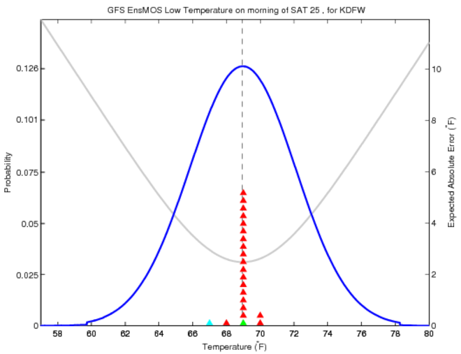
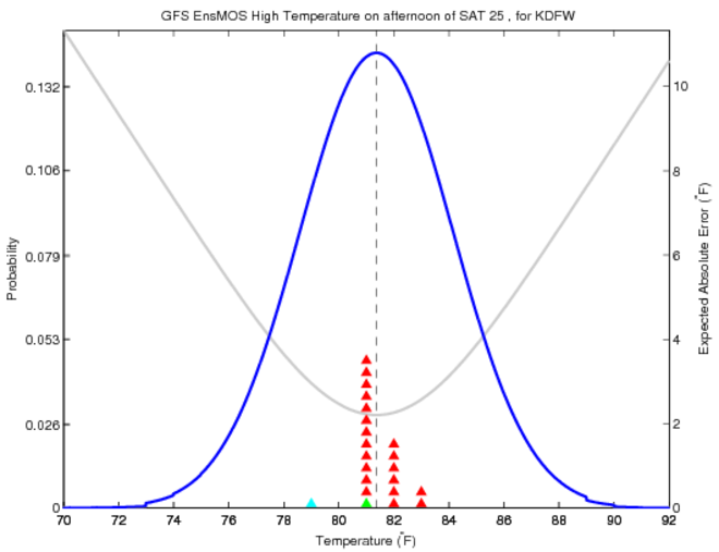
GFS Ensemble MOS: For some inexplicable reason the MOS calculations are only run for the 00z GFS ensemble, so for forecast contest purposes be wary of the actual numbers it puts out, as the latest deterministic GFS MOS is 18 hours younger. Information about the forecast probability distributions from the 00z GFS ensemble is, nonetheless, still very useful. Click here for the current CWFC station.
** Forecast probability distributions based on GFS ensemble MOS ** Click here for an explanation/interpretation (updated 8/24/2006) Tonight's low at CWFC station Tomorrow's high at CWFC station
SREF Meteograms:
Experimental interface from SPC
To produce a 2m temperature meteogram, hit 'submit' in the uppermost frame, and 'submit' in the second frame down. Then, choose a station from the list in the lower-left frame, above the map (or choose a location by clicking it on the map) and hit submit again. An 2m-temperature ensemble meteogram will appear in the lower-right frame. A 10m wind speed ensemble meteogram can also be created, by choosing that variable in the uppermost frame.
If that isn't enough for you ... links to the 'portal'
sites for ensemble output
SREF: NCEP
PSU
SPC
GFS:
NCEP Spaghetti
NCEP PQPF
PSU
Canadian
Pacific Northwest MM5
HPC Ensemble Training Page
Jon Moskaitis- Grad Student
Program in Atmospheres, Oceans and Climate
Massachusetts Institute of Technology
jonmosk@mit.edu
Other pages: Research page
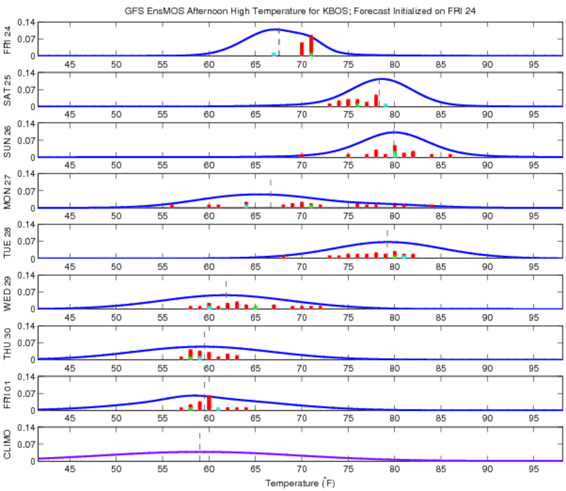
Boston GFS Ensemble MOS: High Temp
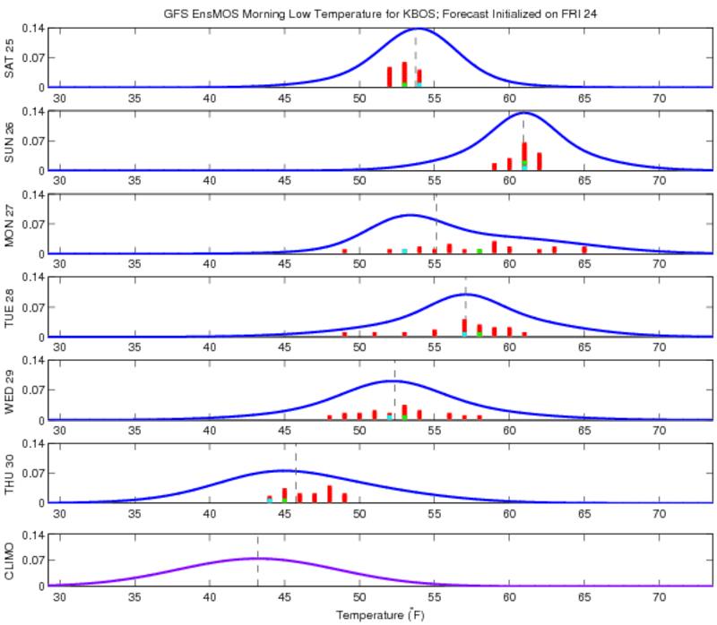
Low Temp
Boston climate
*this site is for entertainment purposes only.
Use this data at your own risk. Official forecasts are at nws.noaa.gov
:-)