12.310 Case Study: December 18-20, 2009 Eastern U.S. Snow Event
December 19, 2009, Charlottesville, VA
Before the storm:
- Numerical weather prediction models showed a storm brewing in the Gulf of Mexico.
- We knew it would be big, but how big? At 24 hours before the event, one model (GFS) was saying 8-12" for Charlottesville, while another (NAM) was saying over 36"!
- How do meteorologists best communicate such a huge uncertainty to the public?
- Do we even trust the numerical models to handle such an unusual event?
Surface analysis maps from Unysis. This is a composite map contain the following analyses: radar summary (color filled areas), surface data plot (composite station
model), frontal locations (in various bold lines) and pressure contours (in thin blue lines).
- December 17, 2009, 7 pm EST: Storm over Louisianna, Mississippi, Alabama as rain
- December 18, 2009, 7 am EST: Storm moves inland over Alabama and Georgia as rain
- December 18, 2009, 7 pm EST: Storm moves northward over Virginia and Carolinas. Snow over cold, inland areas; rain closer to coast.
- December 19, 2009, 7 am EST: Storm continues to move northward and brings snow to Washington, D.C. and Philadelphia metro areas.
- December 20, 2009, 7 am EST: Storm grazes Boston, then moves out to sea.
Some snowfall statistics:
- Charlottesville, VA: 20.5" total. 1st greatest December snowfall event, 4th greatest ever.
- Washington, D.C. (Regan National Airport): 16.3" total. 1st greatest December snowfall event, 6th greatest ever.
- Philadelphia, PA: 23.2" total. 1st greatest December snowfall event, 2nd greatest ever.
- New York, NY (Central Park): 10.9" total.
- Providence, RI: 16.0" total.
- Boston, MA: 10.0" total.
Why so large?
- Gulf of Mexico provided abundant moisture source.
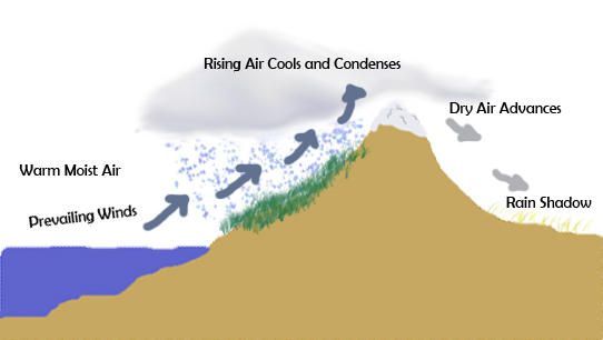
- Storm came from south and moved parallel to Appalachian Mountains. Storms coming from the west will be robbed of their moistre by mountains.

- Storm was classified as Category 3 or "Major" on NOAA's Northeast Snowfall Impact Scale (NESIS)
Wikipedia page

